You are using an out of date browser. It may not display this or other websites correctly.
You should upgrade or use an alternative browser.
You should upgrade or use an alternative browser.
bamabikeguy
Active Member
Thanx bird
Thanks Bird, for putting the link under the map.
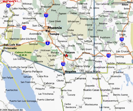
I tried it out, wanted to see if the "aerial view" would print, see if a person could post "in picture form" the terrain you are in.
Well, I couldn't. Our forum needs to find some topographical "map place" so we can compare challenges in AZ versus those guys in the Ozarks and Adirondaks.
But still when you zoom in and out on your link, a person could get an idea of the challenge crossing AZ on a bike.
B
bird
Guest
what ever anyone does dont come here in the summer. i bairly ride these things in the summer unless i realy have to. you get fried at red lights with the heat waves coming off the cars, also the motors have alot more problems with overheating. its hopeless, i siezed my last motor runnin accross town in 120 degree weather.
drimpact
Member
But its a dry heat... Like a blow torch!!
I totally agree, I do my riding early in the morning and the evenings. I have ridden in the hotness of the day but keep my speed, an the RPMs, in check.
Don't leave your bike with a black vinyl seat in the sun or you will not be sitting for long. Nothing worse than a burnt rump!
I totally agree, I do my riding early in the morning and the evenings. I have ridden in the hotness of the day but keep my speed, an the RPMs, in check.
Don't leave your bike with a black vinyl seat in the sun or you will not be sitting for long. Nothing worse than a burnt rump!
T
twinkiex
Guest
I love the hot Arizona sun!
Wearing lots of sunscreen. I rode my mountain bike all summer in the heat of the day. I just drink plenty of water and take breaks.
I agree, you gotta watch the temp of the bike seat and even the brakes handle can get too hot to touch!
Wearing lots of sunscreen. I rode my mountain bike all summer in the heat of the day. I just drink plenty of water and take breaks.
I agree, you gotta watch the temp of the bike seat and even the brakes handle can get too hot to touch!
A
az cra-z
Guest
Hey
I see you live near Old Spanish Trail. Love to ride that road on either pedal or motor bike. It's almost cooled off enough for a group ride, let's think about it!
I see you live near Old Spanish Trail. Love to ride that road on either pedal or motor bike. It's almost cooled off enough for a group ride, let's think about it!
T
twinkiex
Guest
group ride! group ride!
Similar threads
G
- Replies
- 9
- Views
- 4K
L

